Minor Subdivision and/or Lot Split process and instruction
(See below for local recommended Attorneys / Land Agents) |
| |
 Initial design and Consultation: The process of subdividing property has changed over the past decade and many laws have been enacted, and some cases, changed entirely. Considerable thought when determining the best way to divide property should be taken
as there are many different variables to consider. Some of these considerations could be local zoning regulation, health and environmental change issues, natural location to best suite corner areas, structural designs and legal liabilities, just to name a few. Initial design and Consultation: The process of subdividing property has changed over the past decade and many laws have been enacted, and some cases, changed entirely. Considerable thought when determining the best way to divide property should be taken
as there are many different variables to consider. Some of these considerations could be local zoning regulation, health and environmental change issues, natural location to best suite corner areas, structural designs and legal liabilities, just to name a few.
Lot Conformation: The first step in subdividing any parcel of land is determining whether the proposed division conforms to local zoning regulation and will be permitted by The Zoning Commission, The Planning Commission, The Health Department, and in some cases The Soil and Water Conservation District. First, we recommend contacting your local Zoning Commission and consulting with a zoning inspector regarding the initial design. After the proposed lot division(s) has been accepted by the zoning inspector, the next recommended step is determining what will be required by your local Planning Commission. The planning director or agent may require additional information to be shown (see Existing and Proposed Septic System Location and Design below) on the final Plat of Survey (survey map). Finally, The Soil and Water Conservation District should be contacted to see if they will require anything (see Soil and Water Conservation Districts below).
Contracting The Surveyor:
It is important to understand all of what will be required in any lot division so care should be taken when contracting the surveyor to make certain he/she is familiar with all of the processes that will be required. Many times surveyors will under estimate (and under-bid) a survey because of a lack of knowledge of the requirements involved, therefore, if it sounds too good to be true, maybe it is. Usually, much of this information is gained in order to provide the client with an accurate quote before any surveying is ever done.
It should also be said that most of these governing agencies are usually very friendly and helpful to work with and will aid in expediting the survey.
D.B. Kosie and Associates has experience with all of these considerations and can help guild you through these processes.
|
|
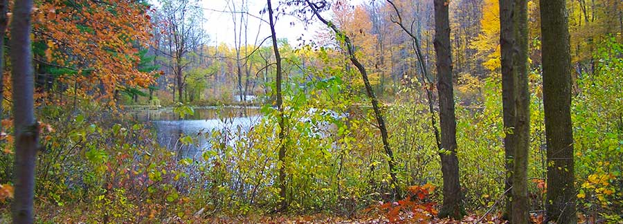
R.L. Kosie - 200 Foot Ravine - Madison Township 2013
|
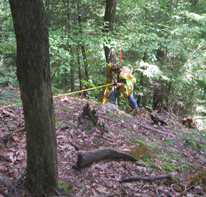
The survey process: After the client has a working design or concept and knowledge of what will be required, the surveyor will then survey and subdivide the parcel(s) as designed. All of the new and existing boundary corner monuments will either be set or found and a new legal description will be created for each new parcel.
.Existing and proposed septic system location and design: At this point it is likely The Planning Commission has required all existing and proposed septic system information to be shown on the final plat of survey. Buildings, driveways, structures, lakes, ponds, streams, rivers, and utilities may also be required depending on the survey. Existing septic system information can be provided by the client by simply walking the surveyor around and showing him/her the corners of the fields, tanks, connection boxes, etc. In some cases a soil scientist may be required to help locate the existing septic information (see Recommended Soil Scientists below). In the case of a new or residual parcel that is a buildable lot and does not yet have a septic system, The Planning Commission may require a new septic design before it will be allowed to be recorded. It is recommended for the client to contract a licensed soil scientist to establish the best location, type of septic system, and replacement field(s) for this parcel (see Recommended Soil Scientists below). The client should arrange the soil science to correspond with the survey. Generally, the soil scientist will submit the septic design to The Health Department and work with them until a proposed septic system is agreed upon. This is not to infer a septic system will need to be erected at this time; this process is simply to establish the location and type of the future septic system to help guarantee interests for any perspective buyers or owners. |
|
.Soil And Water Conservation Districts:
Soil and Water Conservation Districts have also become a factor in the subdivision process, even at the minor subdivision level. Seeding and critical seeding areas, as well as wash stations and construction drive location, silt fencing, existing and proposed contour elevations, proposed drainage and water flow direction, just to name a few, may all be required. |
| |
| Completing the map of subdivision and approval process: After the proposed septic system design is agreed upon and approved by The Health Department the surveyor will then incorporate this design, and complete the Plat of Survey. This final map and the new legal description(s) are then reviewed by The Engineer's Office, The Planning Commission and in some cases other agencies. After approval by all departments has been obtained the survey is then allowed to be recorded. There is usually no fee for The Engineer's Office to review the survey, however, Planning Commissions, Zoning Commissions and other agencies may require a fee. It is prudent to contact them for a current fee schedule. |
| |
| Deed Preparation: Since there are many different types of deed forms, we STRONGLY RECOMMEND a qualified attorney to choose the deed form that best suites the client's interests (see recommended attorneys below). The deed form should incorporate the new legal description as an "EXHIBIT" (The approved original legal description provided by the land surveyor). Although it is possible to retype the entire legal description onto the new deed form and then record it, there is a possibility that something could be omitted or mistyped (typo) and any difference will change the legal description, therefore making the approvals void and the deed non-viable. The surveyor's "original" signature and stamp are also many times required on the legal description for approval and any outdated method of preparing deed forms should be avoided. |
| |
NOTE: T.O.D. (Transfer on death) deeds are something that many people overlook. These deed types bypass probate court and are something that should be considered. |
| |
| Signatures and recording: After the legal description has been approved and attached onto the new deed form, the current owner(s) will need to sign the deed form in front of a Notary Public (or lawyer). This signed instrument can then be taken to The Local County Recorder's Office for the final recording. This procedure may include additional review by The Local Building Department or Auditor's Office depending on what type of survey was involved. In many cases the Lawyer or land representative will do the leg-work. NOTE: It is recommended that all new lot divisions be recorded within 180 days of having them approved by The Engineer's Office as regulations change often. |
| |
| Land tax adjustments: Any division of property may result in an increase in land tax and will usually remove any current CAUV or forestry credits;, therefore, careful consideration should be taken as to when it is most desirable to record your new subdivision and when to re-apply for these credits. |
| |
|
Minor subdivisions have changed in process and regulation dramatically. The Surveyor MUST follow these new regulations. A majority of the TIME and EXPENSE for this is not something the surveyor has any control over. "These new regulations are to better improve our community" by government standards. If you have any issues or complaints regarding this, we STRONGLY recommend you contact your local Engineer's Office, Planning Commission, Zoning Commission, Soil and Water Conservation District, Mayor, State Representatives and Attorney General accordingly.

www.dbksurveys.com
|
RECOMENDED ATTORNEYS |
DAVID L. FUHRY, ATTORNEYS AT LAW
14537 Main Street
Burton, Ohio 44021
PH: (440)834-4492 |
Robert S. Ohly, ATTORNEY AT LAW
15985 E. High Street, No. 207
PO Box 1236
Middlefield, Ohio 44062
PH: (440)632-9090
|
DAVID ONDREY, ATTORNEY AT LAW
100 Seventh Avenue
(THE ELTECH BUILDING)
Chardon, Ohio 44024
PH: (440)942-1034
|
PETERSEN & IBOLD, ATTORNEYS AT LAW
401 South Street, Village Station
Chardon, OH 44024
Toll Free: 866-649-5582
Phone: 440-607-5228
Fax: 440-285-3363 |
CAROLYN PASCHKE, ATTORNEY
10808 Kinsman Road
Newbury, Ohio 44065
PH: (440)564-5562 |
SVETE & MCGEE, ATTORNEYS
100 Parker Court
Chardon, Ohio 44024
PH: (440)286-9571 |